Written by: Catherine Nakalembe, Christina Justice, Hannah Kerner, Christopher Justice, and Inbal Becker-Reshef
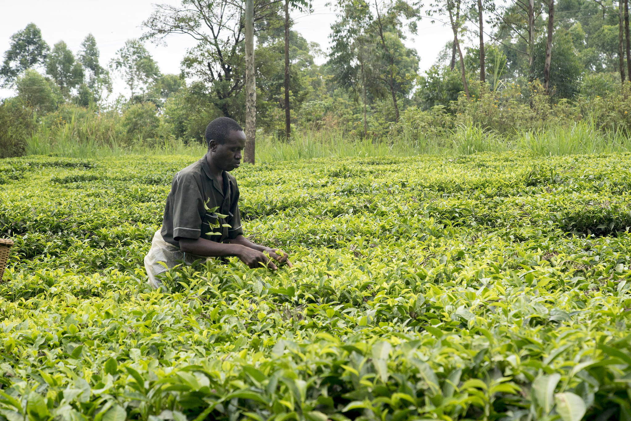
Food security is one of the most pressing issues, if not the most pressing, faced by many African countries today. And events in recent years have increasingly strained food supplies for populations in sub-Saharan Africa. In 2019, Cyclones Idai and Kenneth ravaged southern Africa and coincided with droughts, extreme flooding, and landslides in southwestern and East Africa [Nakalembe, 2020], all of which devastated smallholder farmers.
Last year brought further shocks and setbacks to crop production across Africa. Farmers in East Africa, for example, faced more devastating floods, the most severe (and still ongoing) desert locust infestation in 70 years, and, of course, the COVID-19 pandemic, which has affected every sector and every food system and has brought global food security into the limelight.
COVID-19 disproportionately affects the most vulnerable communities, but it is also affecting previously food secure communities. In 2019, food insecurity already affected nearly 690 million people globally, and by the end of 2020 more than 100 million people were projected to become food insecure because of negative economic consequences attributable to COVID-19 [Food and Agriculture Organization of the United Nations et al., 2020]. With the number of food-insecure people worldwide projected to exceed 840 million by 2030 [Nakalembe, 2020], we are certainly not on track to achieve the United Nations’ “Zero Hunger” Sustainable Development Goal.
In sub-Saharan Africa, agricultural system shocks in coming years will continue to have severe impacts on the food security of smallholder farmers. Analyzing the nature and extent of these impacts and assessing their significance on livelihoods are important in planning responses and mitigation efforts, but these can become overwhelming tasks with only conventional capabilities like on-the-ground observations and surveys of farmers. Satellite-based Earth observations (EO), which provide crucial information about crops in near real time, can play a vital role in supplementing such capabilities, enabling earlier warnings of disasters and supporting response programs involving risk financing and other measures that reduce food insecurity.
Harvest is a NASA Food Security and Agriculture program that seeks to strengthen food security by producing and distributing relevant and actionable information on agricultural conditions and production outlooks at national, regional, and global scales. In particular, the Harvest Africa initiative is spearheading the uptake and integration of EO data by national and regional agencies to support decisionmaking and to benefit food security, agriculture, and human and environmental resilience in Africa. Harvest Africa has prioritized four pillars to achieve its goals:
- Improving monitoring and early-warning systems that provide actionable data and information about agricultural productivity and food security at multiple scales
- Advancing methods that underpin the relevant EO data and systems
- Developing and transferring capacity to national and local users in Africa who influence decisionmaking
- Developing strong, long-term, sustainable partnerships
EO-Based Monitoring
With heightened uncertainty about the numerous threats to crop production today, like increased flooding, drought, and pest infestations, there is a need for more frequent and detailed agricultural reporting to inform international consensus as well as responses at regional and national levels. This information can reduce speculation about crop production and food availability and provide early warnings of potential production shortfalls, which are especially critical for regions at high risk of food insecurity.
Harvest supports these needs through its role in the international Group on Earth Observations Global Agricultural Monitoring Initiative (GEOGLAM). Harvest coordinates the GEOGLAM Crop Monitor for Early Warning (CM4EW), which provides timely, science-driven information on global crop conditions. This information comes from satellite-derived indicators of vegetation conditions (based on the normalized difference vegetation index), precipitation, temperature, soil moisture, evapotranspiration, and runoff. CM4EW also facilitates information exchange across the international community, building consensus among major agricultural monitoring agencies [Becker-Reshef et al., 2020], reducing uncertainty in global crop condition assessments to support agricultural and humanitarian decisionmaking, and synthesizing these consensus assessments into monthly bulletins.
In East Africa, at the national level, the Crop Monitor has been adapted and adopted for full operational use by national ministries in Kenya, Tanzania, and Uganda, and it is currently in development for use in Mali and Rwanda. And regionally, the Intergovernmental Authority on Development, which represents eight East African countries, has led the East Africa Crop Monitor through its Climate Prediction and Applications Centre (ICPAC). This system has become a leading data source for food security information that complements and contextualizes ICPAC’s seasonal climate forecasts.
Harvest is also leading the development of a NASA Harvest COVID-19 Price Monitor Dashboard and coleading an international locust monitoring working group. The dashboard incorporates different EO data sets and market information to help draw useful connections between COVID-19 impacts on agricultural production and their effects on markets at various scales. The locust working group has supported the development of critical EO data sets needed for monitoring the ongoing locust invasion in East Africa.
Developing Improved Methods
EO-based monitoring systems and decisionmaking with respect to agriculture and food security rely on accurate and up-to-date products such as maps of land cover and crop type, conditions, and yields. Harvest is developing new methods to improve these products, using machine learning, biophysical and agroecosystem models, and statistical techniques. To promote the operational uptake and sustainability of these new methods, Harvest is codeveloping methods with stakeholders from the outset and is making models and data sets publicly available whenever possible.
For example, we have developed a new method (a multiheaded long short-term memory, or LSTM, model) for postseason and in-season crop classification using deep learning in combination with satellite data from Landsat 8, Sentinel-2, and Sentinel-1, as well as with commercially available fine-resolution data from Planet Labs [Kerner et al., 2020]. The LSTM learns from global and local training data to detect crops in multispectral time series data.
Products created with this method, such as 2019 cropland maps for Togo and 2019 and 2020 in-season maps for Kenya, provide decisionmakers with trustworthy information on where crops are growing and how those crops are performing. The Togo map, for example, provided information about the size and location of croplands that census data might have missed. It also supported Togo’s YOLIM program, an interest-free digital loan program designed to boost food production across smallholder farms by funding the cost of farming essentials like fertilizers, pesticides, and tractor rentals.
As there are few publicly available training data sets for crops in smallholder regions in Africa, our machine learning models are being designed to leverage diverse, global crop data sets to augment this sparse availability while still being tailored to account for regional differences in growing practices, crop calendars, and other factors [Becker-Reshef et al., 2020; McNally et al., 2017]. We are also addressing the scarcity of training data by working with organizations and extension agents in partner countries and by developing methods to scale and sustain ground data collection. Harvest researchers, for example, have trained networks of extension agents and students in Mali, Tanzania, and Uganda who collect ground data in partnership with Lutheran World Relief in Mali, the Office of the Prime Minister in Uganda, and Sokoine University of Agriculture in Tanzania. Harvest is also set to lead a Lacuna Fund project called “Helmet Labeling Crops” in five countries to deploy a rapid semiautomated approach to developing an unprecedented training data set for machine learning applications.
Building Capacity in Africa
Harvest Africa has invested heavily in capacity building to advance how crops are monitored in sub-Saharan Africa and to ensure that EO systems and methods are responsive to user needs and are filling critical data gaps. To do this, we have focused on melding local knowledge, resources, and expertise with our own to better understand existing problems and to help identify and prioritize institutional needs.
We have also worked with our national partner organizations to enhance their capabilities to access and use available data and resources and to prevent project frame failures and unintended consequences of half-baked solutions, such as short-tefrm projects that end too suddenly or the implementation of systems that are not fit for purpose. Our approach also links our partners with the broader EO and development community, further enhancing capacity through exposure to the skills and experience of other researchers and organizations.
The result of these capacity-building efforts is that there are now networks of trained Crop Monitor “champions” who are versed in making EO-based assessments of crop conditions. These champions lead national efforts and participate in regional Crop Monitors, and they contribute to the CM4EW, bringing critical national-level insights to the global context. As noted above, extension agents also provide valuable ground-based data and information, so that even in 2020, when travel restrictions made it impossible for national and international experts to carry out ground assessments, we had means of reliable data collection and sharing.
Networks and Partnerships
By design, NASA Harvest is a partnership of partnerships—a multidisciplinary and multisectoral consortium of leading scientists and agricultural stakeholders in both public and private organizations. In Africa, we have partnered with government departments, nonprofits, and international development organizations to improve outcomes for end users. These partnerships have proven essential in ensuring access to critical technical expertise and EO and ground-based data sets and in facilitating and funding training events.
In response to a request from the government of Togo, for example, NASA Harvest worked with Planet Labs to access very high resolution data needed to generate the high-resolution cropland map that the government used to support its YOLIM program.
A satellite-based Global Agriculture Monitoring system developed by the University of Maryland in partnership with NASA and the U.S. Department of Agriculture was customized for East Africa, enabling implementation of the World Bank’s Disaster Risk Financing and Insurance Program. In Uganda, this program has supported more than 300,000 individuals in the Karamoja region, providing alternative livelihoods to smallholder farmers affected by drought.
Extending the CM4EW system to Kenya and Rwanda, meanwhile, was achieved through direct collaboration between Harvest and the multination Regional Centre for Mapping of Resources, with support from the NASA– and U.S. Agency for International Development–sponsored SERVIR program.
And in yet another example, a partnership with Lutheran World Relief in Tanzania directly led to the Relief to Resilience project in Mali, which is strengthening the early-warning system there by increasing the capacity of government agencies to monitor crop conditions using EO data. This improvement in turn contributed to the development of the Mali Crop Monitor, which has been integrated into Mali’s early-warning reports.
A Call to Action
The COVID-19 pandemic along with ongoing climate- and weather-related extremes presents unprecedented challenges for food security, in Africa and elsewhere, that we are yet to fully understand. But there are opportunities to use EO to help address these challenges. It is more critical than ever for researchers to use the tools and research available—and for these tools and data to be openly accessible—to help national governments and organizations working to mitigate the negative effects of food system shocks. Prioritizing smallholder farmers in this effort is particularly vital because it is abundantly clear that these farmers cannot be ignored if we are to end hunger for everyone [Nature, 2020; Laborde et al., 2020].
The Harvest team is continuing to put the best information and tools into the hands of decisionmakers and, ultimately, smallholder farmers. And the science-driven and actionable research, national-level capacity building, and global coordination via the GEOGLAM Crop Monitor that Harvest coordinates are offering earlier and more accurate warnings of potential threats to crop production and food security.
This work is translating research into tangible, positive outcomes for farmers and communities vulnerable to food insecurity. Through such open science and coordination among local, national, and international groups, we can leverage everyone’s combined knowledge and resources and make systematic and measurable progress toward ending hunger.
Header Image Credit: Peter Kapuscinski / World Bank (CC BY-NC-ND 2.0)

This story originally appeared in AGU’s EOS Magazine and is republished here as part of Covering Climate Now, a global journalism collaboration strengthening coverage of the climate story.


